im trying to map a road onto a terrain ive made in blender. Its for an architectural project so therell be sections and what not taken of the terrain so the roads need to be more than superficial uv maps (since they wouldnt show up in a section!)
Im going to want to be tracing the road over a background image map and then drape it or stamp it onto the terrain. the desired outcome is that the road sits a little below the terrain and is fairly if not completely horizontal on the x and y axis so there is a pavement on either side.
ive looked at various tutorials and posts on this forum but i cant seem to find what im looking for. any help would be amazing!
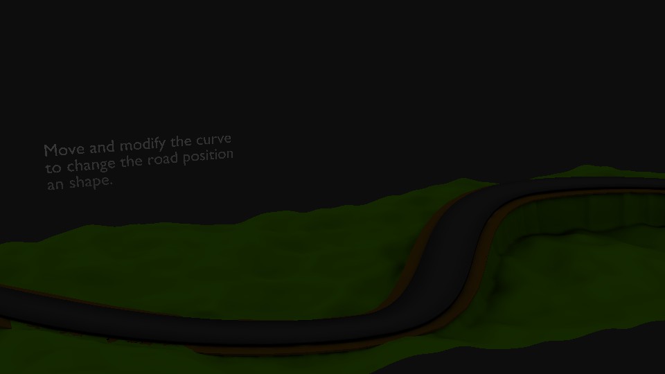
But the most comfortable solution should be a Path object (Add -> Curve -> Path). You can use snapping (bottom panel: magnet switch, select Face from the menu right next to it) to put the points on the terrain mesh.
To give the path some width, change its Extrude parameter (Properties window -> Geometry -> Extrude) and set Twist Method to Z-Up (Properties w. -> Shape -> Twisting menu). To make it horizontal, select all points of the curve, call Tilt (Ctrl+T), type 90 and confirm.
The path should have an auto-generated UVMap, so it should be nice to work with. You can later convert it to mesh using Alt+C.
Here is one way to fit a road to a landscape. You can use this as a modeling tool to shape the landscape then apply all the modifiers to lock down the mesh. It does not deal with intersections or cross roads but it might give you something to start with.