Just been reading the thread which Has been closed and mentionS several times that the BGE no longer used. Certainly made for amusing reading.
Just a little reminder that I only use 2.79b and find it excellent for making interactive real life simulations which can include numerous embedded scenarios.
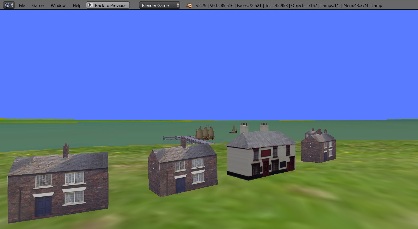
I you wish to use the KIS principle (keep it simple) it works fine. for maritime routes from about 10 to 40 km. All the route I make are up to or below 5 meg zipped and can be downloaded from the the Blender Artists pages.
I am am no longer including screenshots as there are plenty on the various pages. Anyway would only take a minute or so to download any of the routes?
All routes are free but use strictly at your own risk.
Not for commercial use. B
I will possibly change to harbours and docks only, instead of including river systems etc. So age of steam but that also will include guesswork.
Possibly only use OSM. and no longer create whole maritime areas as before, although easy enough to create them using greyscale height maps and srtm2 data. I think this new approach would be more suitable for my own interests. Other reasons are as I mentioned before. I will still make the animated docks, etc, free and downloadable from Blender Artists and under or up to 5 meg zip file.
I think possibly not is the better choice considering everything.
B
More thinking, more considering all the aspects of these forums.
Size of each route 6.kilometers approx, possibly 10 by 6 kilometers
Using grey scale height map to generate the terrain.
Created using 3DEM and OpenStreetMap.
Starting from beginning from Solway Firth.
Only some harbours or docks visible on Open Street Map will be included.
Limited to 5 meg max to enable them to be downloaded from Blender Artists.
B
With the abandonment of the game engine, no longer practical for me to continue. The readme I made gave the download url address of the archives which appears to have altered for Blender 2.79b My downloads for the maritime routes are up to about 5 meg zip, in line with forum requirements.
However as 2.79b is required I can’t expect people outside the close knit, limited interests of BA forums to search for them.
To create routes it became necessary to use greyscale which again has now become tedious to make. As making serious simulations seems to be a lost cause on these forums there is no point in me posting further. B
B
I suppose if people were having problems with downloading 2.79b I could explain in more detail. As regard the script that has been altered to to one degree which is outside making routes up to 5 meg zip. The original was 3 degrees I think at 90 meters srtm2 which I used.
Usually I can use the displace function OK with greyscale height map and using 3 DEM, but last time after several hours I gave up. The setting for ‘strength’ is guesswork, but might retry.
As I no longer make screenshots, that seems to have stopped all the ‘like’ posts which is what I suspected would happen and not important. I have no idea how long the routes take to download, maybe from seconds to a few minutes maximum for zip file ! Usually about a minute or so for myself.
B
Considering very small routes at 6 km square, possibly 12 km if I use openstreet map if enough detail.
Start Solway Firth. Using 12th rule using part of the 6 hours over 10m height maybe, one drivable, rest ‘floating’. Starting at mid-tide. This will enable sand-banks still visible to b gradually covered. Steamers would not work for drivable, small paddle steamer will, so will sail. I have used this tidal method before. B
P.S. Max. height of area was 40 m and after a couple of hours and 2 remakes not accurate enough. B
Circumnavigation I don’t think would be practical now due to the chain of events from different factors. However I might be able to continue for my own interest if the greyscale height maps will work for the larger routes of about 30km.
The new ship sim delayed through the corona-virus until next year.
So whatever happens with that, timewise it is of no further interest to me.
So I will continue for my own interest in ships and boats. So no further drivable, only preset routes. I don’t need drivable and it only seems to work with sail. Ships etc using timeline for any animation. Textures basic.
Steamships only and might back-track to the Ribble for a new start and ignore the Solway Firth for which here are several routes for download, steam and sail., few if any buildings, under/up to 5 meg to enable the free downloads . Liverpool will be ignored as plans were was based on about 1800 and dock depth and dock gates only suitable for sail… However I made a version available for sailing ships and free download.
Time for me also to look at the steam-engine routes in open-rails which is open source simulations. So it looks like my interests now basic steam-ships in bLender Artists, and looking at steam steam-engine routes in ORTS.
http://www.openrails.org/
B
However as I have already made over the years the routes from the Solway around to Cornwall I only need to unravel what is already made as regards the terrain. Back to the sailing ships, 4 variations already made. All drivable, sail vessels could be converted to preset routes and any variety of sail-shipa animated preset route scenes can now be made as I don’t need drivable and nor do I need to make any further embedded scenarios, collect cargos or crew. Deliver cargo etc. All simply made by using visible/invisible function.
Also there will be gaps with some routes missing so they can wait for another time. That can end now these changing details trying to adapt. All routes will be made available for download free and below the 5 meg limit on the forum.
IThanks. B
07092020
Blender seems to have abandoned routes and simulations.
Forever trying to work my way around the problems.
First started around 2004 on and off so a good few years.
would be a pity for me to pack in the route-making, especially as I seem to be making the just for myself for my interets. So on that basis I might continue for rivers and harbours. B
B
More ideas. Same as before as regards free and up to or under 5 meg, to enable them to be downloadable from the Blender Artists pages as a zip file. The version of Blender required will be 2.79b. I will not be using any versions of Blender from 2.8 onwards.
The difference will be all routes after this post now steam-ships dating from approx. the beginning of Queen Victoria reign, not before 1837. Of course many will probably still be be guesswork and will use Open Street Map as a guideline for some.
Content will be harbours, docks, steamships, no sail. Any vessel movements if included will be preset and no drivable, no further scenarios.
The start will be Solway Firth and am using Blender grey scale displace function and 3DEM and srtm2 for the height map, so terrain will probably be approx, but will not matter as the main part is the strip of coastline, or river system. I am only interested in Blender 2.79b, no other version. Some docks built before 1837 might be mainly for sailing ships and too shallow.
B
Age of Sail
Most will have been listed previously.
Most however, starting from this section will have some alterations.
To enable the maritime routes to be downloaded from this page each route is up to about 5 meg and below. Starts from Solway Firth.
01annanpreset23102020.zip (3.4 MB)
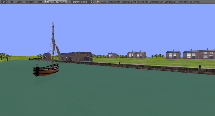
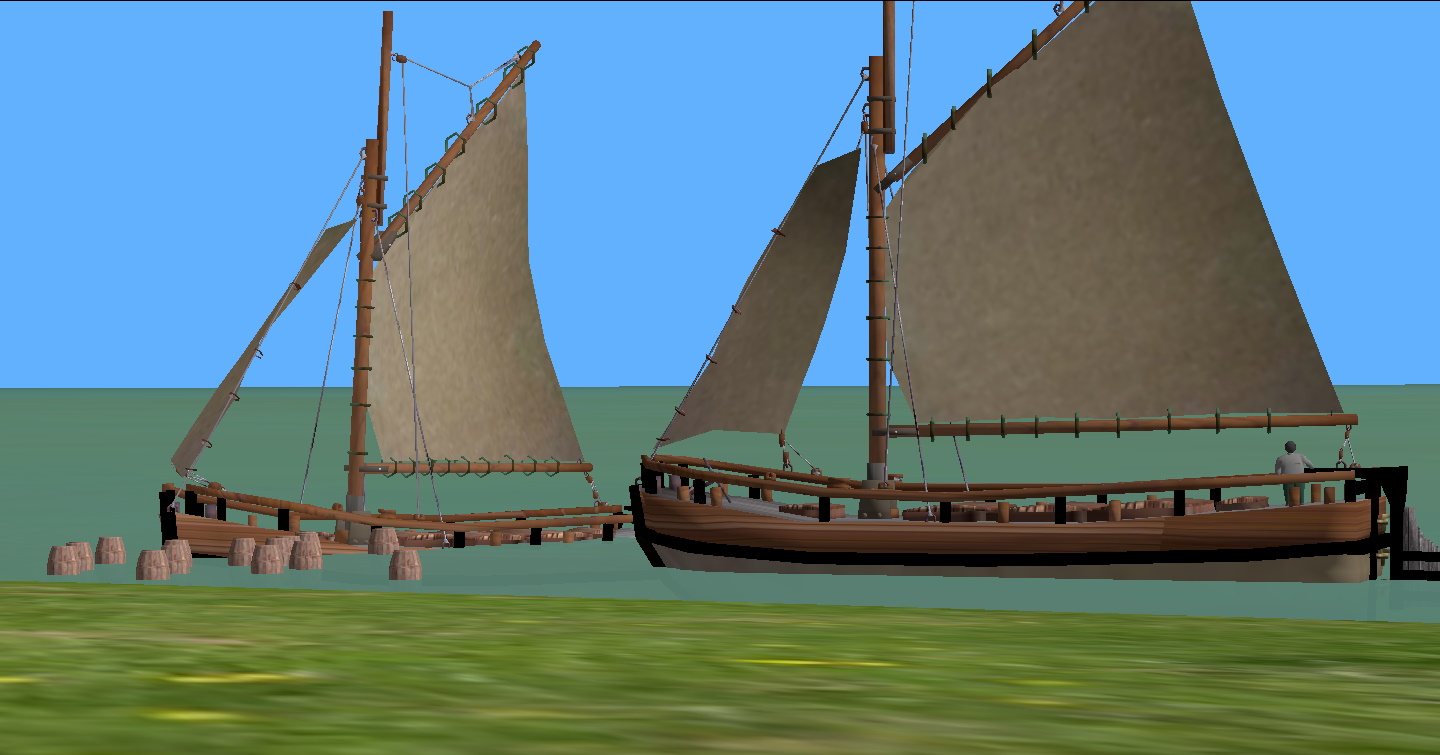
Drivable sloop and schooner, jib and 2 masts on schooner. Sloop single sail and jib enabled to collect barrels from stone quays.
Distant schooner on route to wood piers.
Sailing flat on route upriver.
Sailing flat hull launched down ramp
Roaming camera home/end/arrow-keys
keys 1,2,3, for preset.
Drivable, wasd for sloop, ijkl for schooner.
Refer to enclosed readme.
Use entirely at your own risk.
Not for commercial use.
B
Sailng-flat on its way upriver
Drivable Sloop on it way to collect barrels.
Distant schooner nears the wood pier.
Age of Sail
Upper Solway Firth.
Rivers Eden and Esk and the small river Sark running close to Gretna Green. Further details in the readme enclosed in the zip file.
Use Strictly at your own risk.
Not for commercial use.
Many details and content might apprroximate or guesswork.
Roaming camera home/end/arrow keys.
Key 1 starts the sailing flat on route to Rockcliffe. Maybe half an hour or more. Starts very slowly before leaving the jetty.
02solway25102020.zip (4.8 MB)
B
03 Silloth
Screenshots to be added later
03silloth26102020.zip (4.8 MB)
The drivable vessels are left corner back of inner dock, sailing-flat tfgh, schooner ijkl
roaming camera home/end/arrow-keys. key 1 opens dock gates.
Scenario collect crewman from half submerged sailing-flat and collect barrels using sailing flat and schooner. Details in readme.
off to help crewman
crewman rescued
Simulations can easily include any amount of games but called interactive scenarios. They can be as difficult or as easy as you wish.
For example to collect the barrels you have to use the schooner. To help the crewman you have to use the sailing flat. Just checked to see if it is possible using the sailing-flat first. The barrels are floating. It took me about half an hour to gradually push and clear the barrels, then manoever in close to rescue the crewman.
I think you could reduce the friction on the barrels to make it easier to push them clear if using the sailing- flat first. Progressing nicely. B
P.S. As with all these routes use strictly at you own risk.
Not for commercial use.
Details might be approximate and some guesswork.
Carrying on along the Solway Firth and next will be Maryport (eventually). B
P.S. From Maryport up to Whitehaven I am going to use the steamship routes already made. Also add the Silloth route. The docks are larger and more suitable for the coastal ships. Probably from Fleetwood onwards perhaps use the sailing ships. Difficult to know when all the docks were constructed. So it’s a case of changing from sail to steam-ships then back again. The Liverpool and river Mersey docks route I made are based on plans of about 1800 built at about one and half miles. 1833 maps show docks double in size at about 3 miles. Later versions became more for the large liners and steamships. They eventually grew to about 7 miles in length, before the upper reached started to be closed down or silted up or built over.
To continue with the made steamship routes we will start at the English side of the Solway Firth from Silloth. They will all be preset routes and operated form the keyboard to start the animation. There will be no drivable vessels and no floating. Size as always up to or below 5 meg for complete route including all textures.
B
to be possibly uploaded later as requires further work on it.
Try again apparently building was linked to graph for some reason.
03sillothsteam28102020.zip (3.4 MB)
key 1 opens the dock gates and starts the 2 cargo ships moving to the wood pier. key 2 start the distant cargo ship om route to the outer dock.
roaming camera home/end arrow-keys.
use strictly at your own risk.
Not for commercial use.
Maryport is the next dock along the coast.
Screenshots later.
Use strictly at your own risk.
Not for commercial use.
04maryportsteam.zip (3.1 MB)
roaming camera home/end/arrow-keys
key 1 opens the 2 sets of dock gates and starts the animation of cargo ship from one dock to next.
To start the manoever of the ‘launching and tow’ key 2
If I continue I think it will be cargo ships rather than sail. B
1 Like
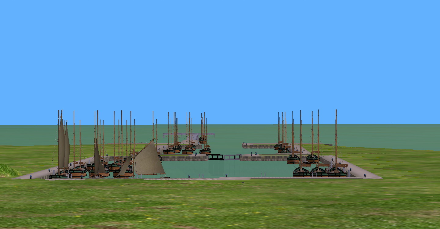
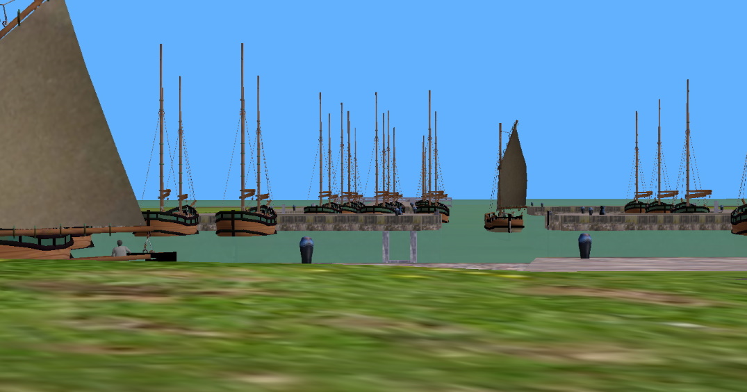
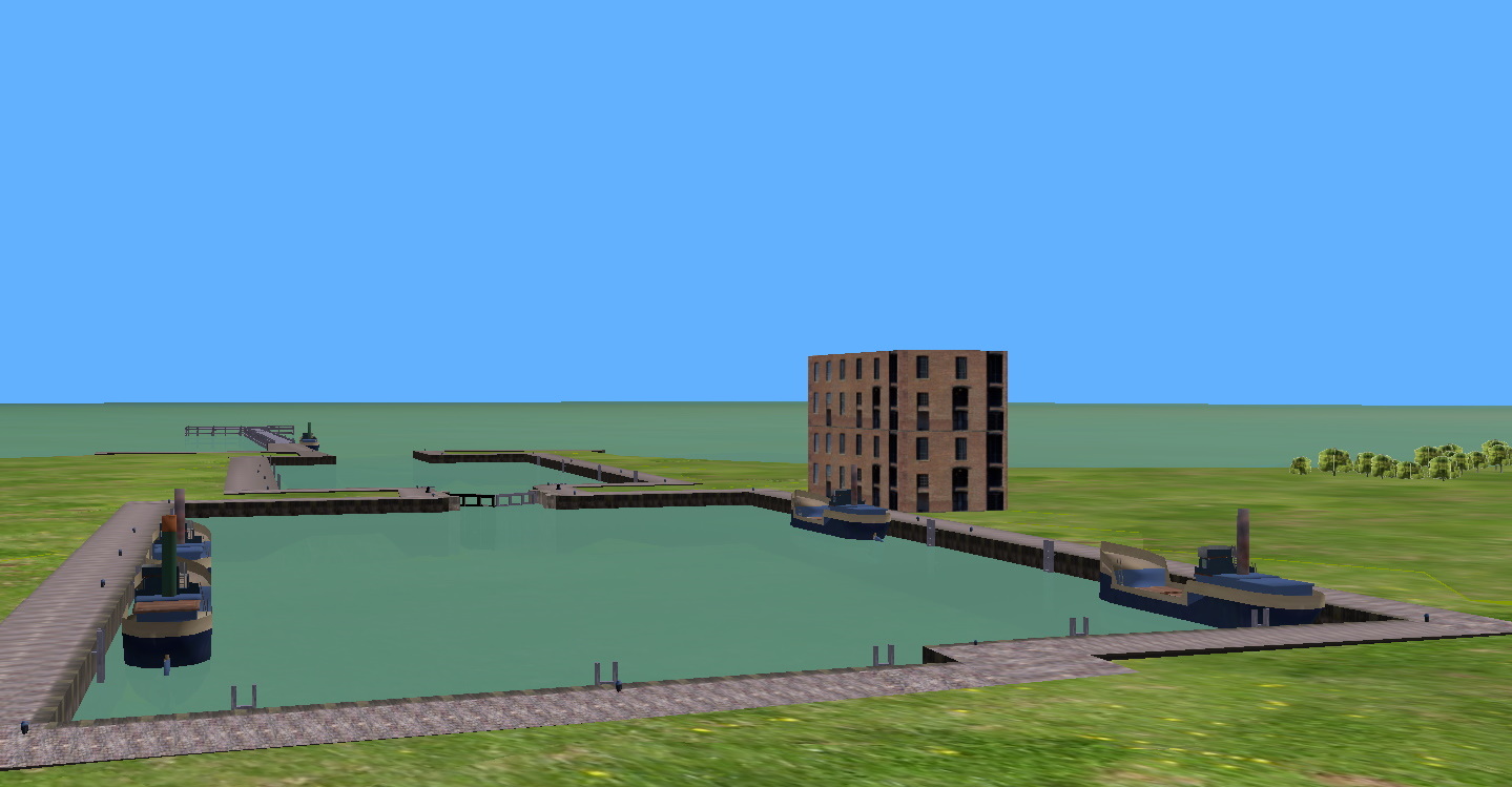
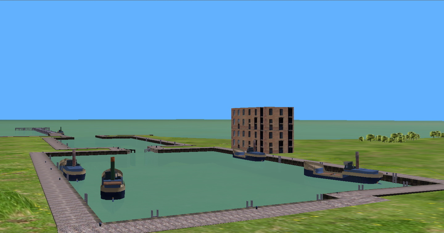
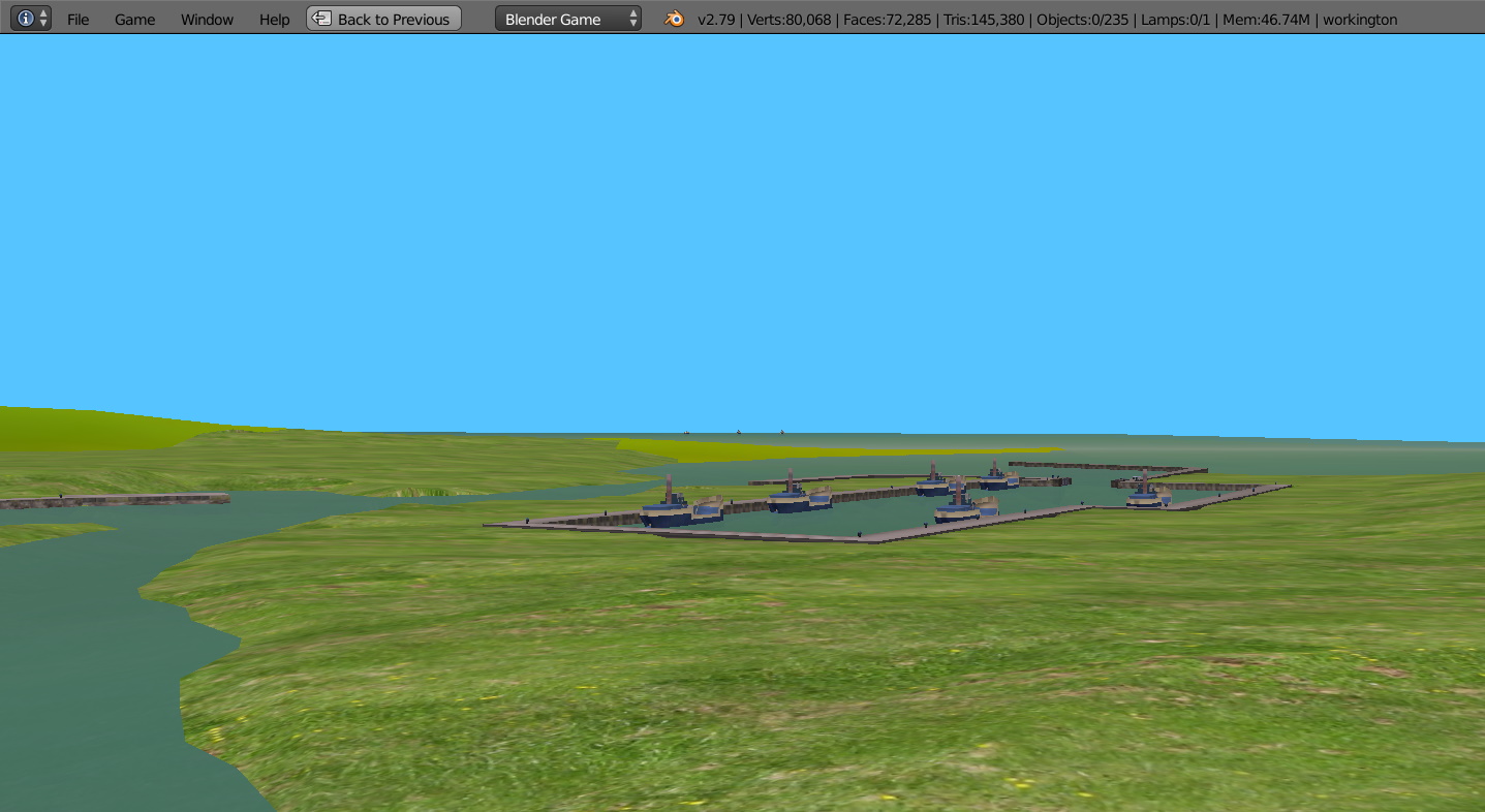
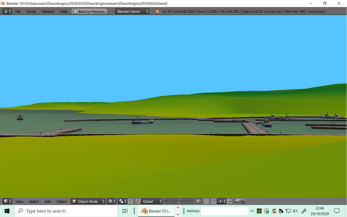
05 Workington - Harrington - Whitehaven.
3 different docks in the one route. Steam Ships
Use strictly at your own risk.
Not for commercial use.
keys 1,2,3,4,5,6.
keys 123 starts the cargo vessels on distant horizon, into
Workington Dock/
key 4 starts movement of steamer in Harrington docks.
keys 5 and 6 start movement of vessels in Whtehaven docks and other vessel out of docks to Workington Docks. See Readme enclosed.
05workington29102020.zip (4.4 MB)
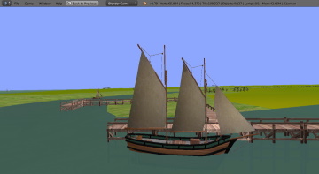
![3_vessels_enter_docks|690x379]
(upload://iYcgiE4bE9iUU0BBs5R6WY3Z3bO.jpeg)
Vessel leaving Whitehaven docks for Workington docks
If I continue it will be Scotland as made enough of England and Wales on the various pages. So would start from the Solway Firth, starting from the wood piers of Annan. Maybe just cargo vessels (non drivable just floating-static and preset routes. B
P.S. A couple of ‘Clyde-Puffers’ would do with the whole of the Scottish coastline to explore.
Obviously due to the changed nature of Blender routes might be just sail or only steamers, or of course maybe be nothing.
Impossible now to make any further forecasts of what I am making or might make, etc. I think that approach is the best suitable for these forums! B
I would be very interested to hear about any transport simulations (not space), made only with 2.79b embedded Blender. Especially maritime but flight, rail and road I am sure are possible.
The must be FREE and also they must be below 5 meg zip file including textures. This is to enable them to be downloaded direct from the Blender Artists forum.
They must be made with the default 2.79 program as it contains all the functions necessary to use direct. If you have to chase up add-ons for it to work then it is of no use to make downloadable for Blender.
Quite complex routes can be made with numerous animations.
All my routes are up to or below 5 meg zip and can be downloaded direct from Blender artists pages. With my thanks to the Blender Artists Management.
Considering very large large routes again at 40 km possibly 25 km, but depends if I can get the grey scale height maps to works satisfactorily again, made from srm2 satellite data and 3DEM. So I may experiment with adding more free routes for download.
B
I think time for me to look at Ubuntu or similar and get away frorn the latest Window 10 updates. B
1 Like
Not sure which forum for this.
Think of getting cheap laptop and keep for Ubuntu - still got ISP with with windows 10.
I would then keep main desktop seperate.
Would need new email, for online etc.
Have used desktop various computers for about score of years but no longer want windows 10.
Would appreciate links for Ubuntu ‘beginner’ of 4 score. Thanks B
been a while since i tried linux, but linux Mint is well known for trying to mimic windows in UI, and also highly recommended for beginners since theres less need to dig around a command console, but little preventing you from going into advanced things if you want.
ubuntu is more of a thing on its own, but i see inspiration from mac os showing. i dont think beginners are prioritized here quite so much.
now theres a recent distro called Elementary os which is the current leader of user experience. i highly recommend it.
each distro has variations geared towards different hardware levels. i couldnt tell you off the top of my head what they are.
EDIT:
but be warned, you will be limited to what software can run on linux. most things like ms office will need a replacement like libre office or openoffice, which come preinstalled anyway. there is an app store to make it easier, but the selection is limited.
isp and email have no connection to your pc. email, if you use a thing like outlook, can still be accessed by just opening any old web browser.
isp is generally connected to your modem and/or router. just plug in a lan cable or connect to wifi and youre good to go.