
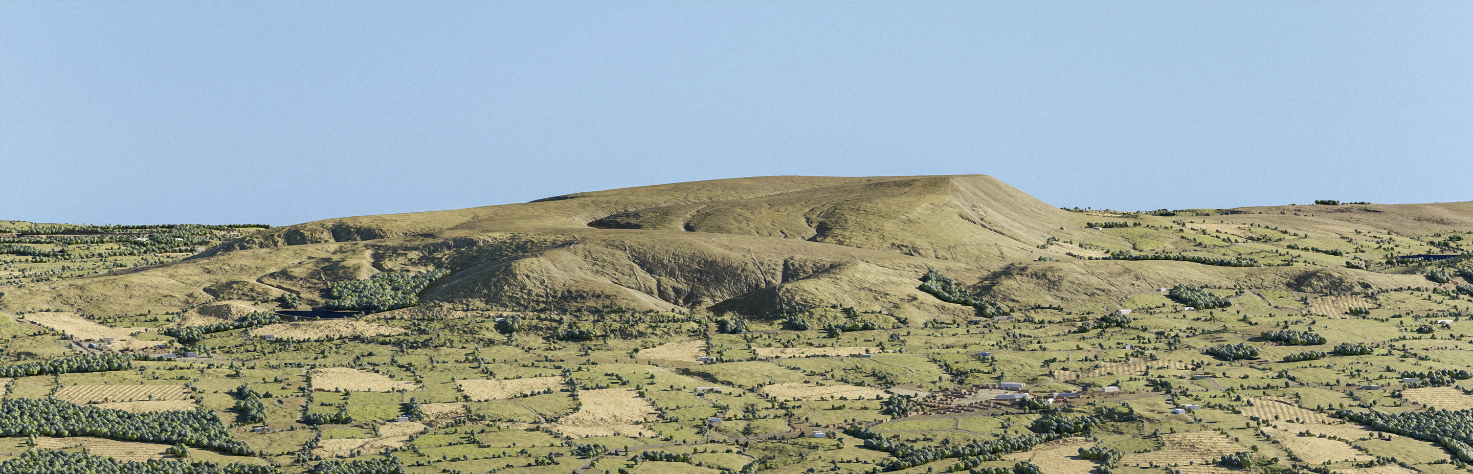
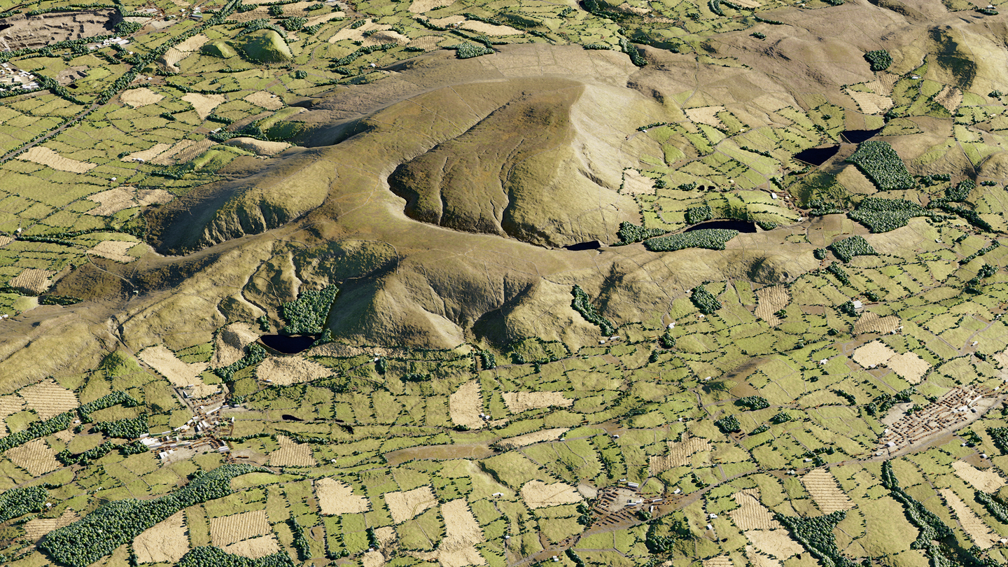
The one thing (well, not really the one thing, more like one out of a million things) that I think undermine my fake CG landscapes is the lack of fields and variations in the landscape and things like that.
This is a test of a new workflow I’m trying to give my landscapes a bit more of a realistic vibe. As a matter of law, I have to cite:
Morton, D.; Marston, C. G,; O’Neil, A. W.; Rowland, C. S. (2020). Land Cover Map 2019 (25m rasterised land parcels, GB). NERC Environmental Information Data Centre. doi.org/10.5285/f15289da-6424-4a5e-bd92-48c4d9c830cc
This is because I have used the The UKCEH Land Cover Maps for 2019 and done lots of boring GIS things with it in QGIS (the field boundaries shown here are not accurate, but they give a decent enough impression for a first go. I can’t afford a full OS licence to make it perfect - and perfection isn’t what I’m going for anyway…).
Software used:
QGIS
Gaea
Blender
Photoshop
Quixel Mixer
As well as LIDAR data from DEFRA, open source OS data and bits and bobs from Open Street Map.
The idea will be to use the above technique (once honed) to make my far off mountain scenes look a bit better.
Still improvements to be made, but all good fun (for me). Weather is rubbish anyway, so need to stay occupied while its horrible outside.
Can anybody guess where this is? Only prize is pride!