[The Uk government has released free Lidar scans] (https://environment.data.gov.uk/survey)
but I haven’t had any success using blender GIS to import the tif files.
What is the best way to do this?
[The Uk government has released free Lidar scans] (https://environment.data.gov.uk/survey)
but I haven’t had any success using blender GIS to import the tif files.
What is the best way to do this?
Use the .tif in a displacement modifier or plugged into a displacement node in Cycles.
You will need lots of subdivision in the mesh.
I am assuming it is a B/W image.
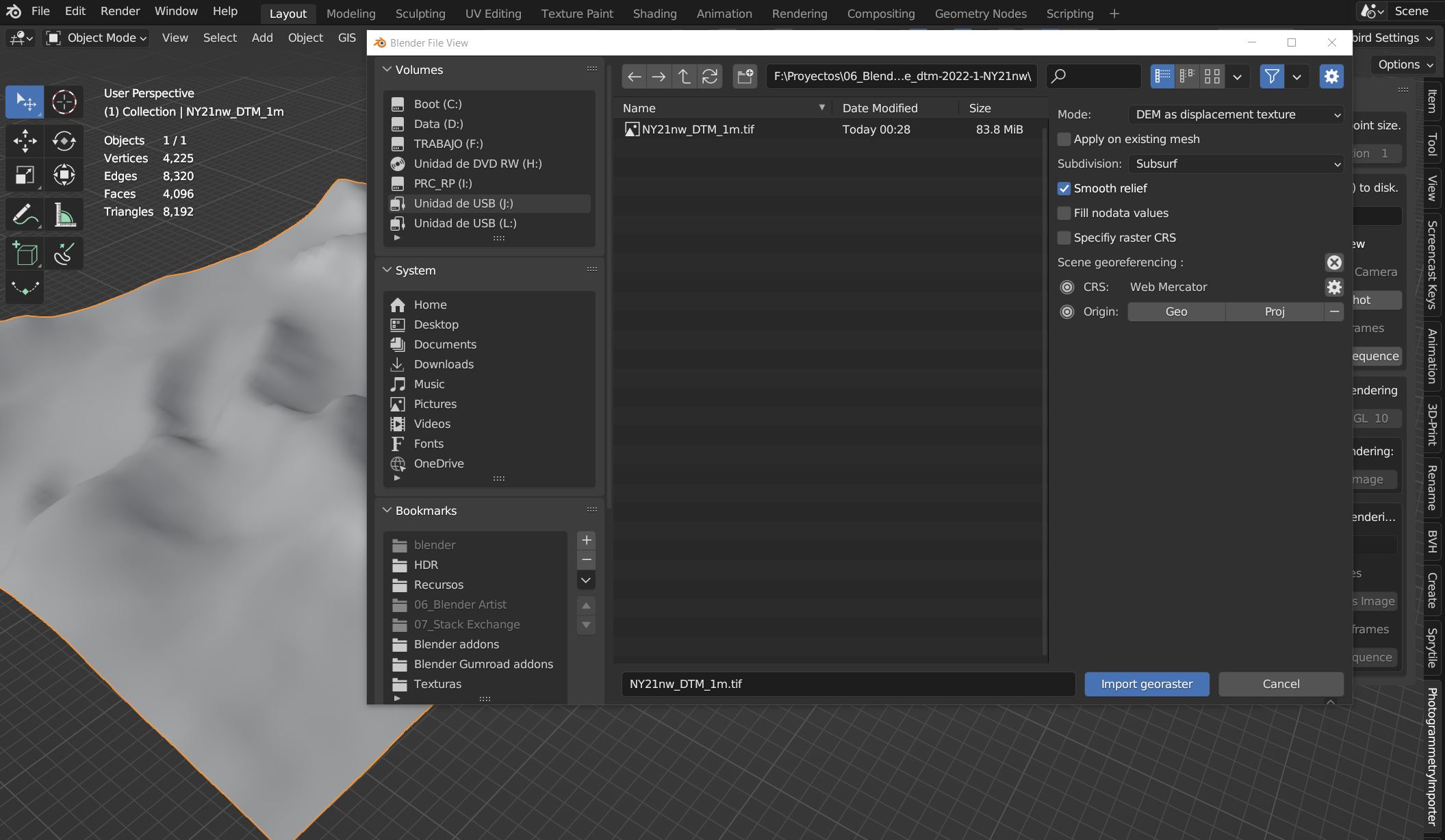
Which format are you downloading and what are your importing settings in BlenderGIS?
Choosing LIDAR Composite DTM and importing .tif DEM with BlenderGIS as displacement texture is OK for me:
For LIDAR Point Clouds (.laz or .las files) better use the Photogrammetry importer addon:
https://github.com/SBCV/Blender-Addon-Photogrammetry-Importer
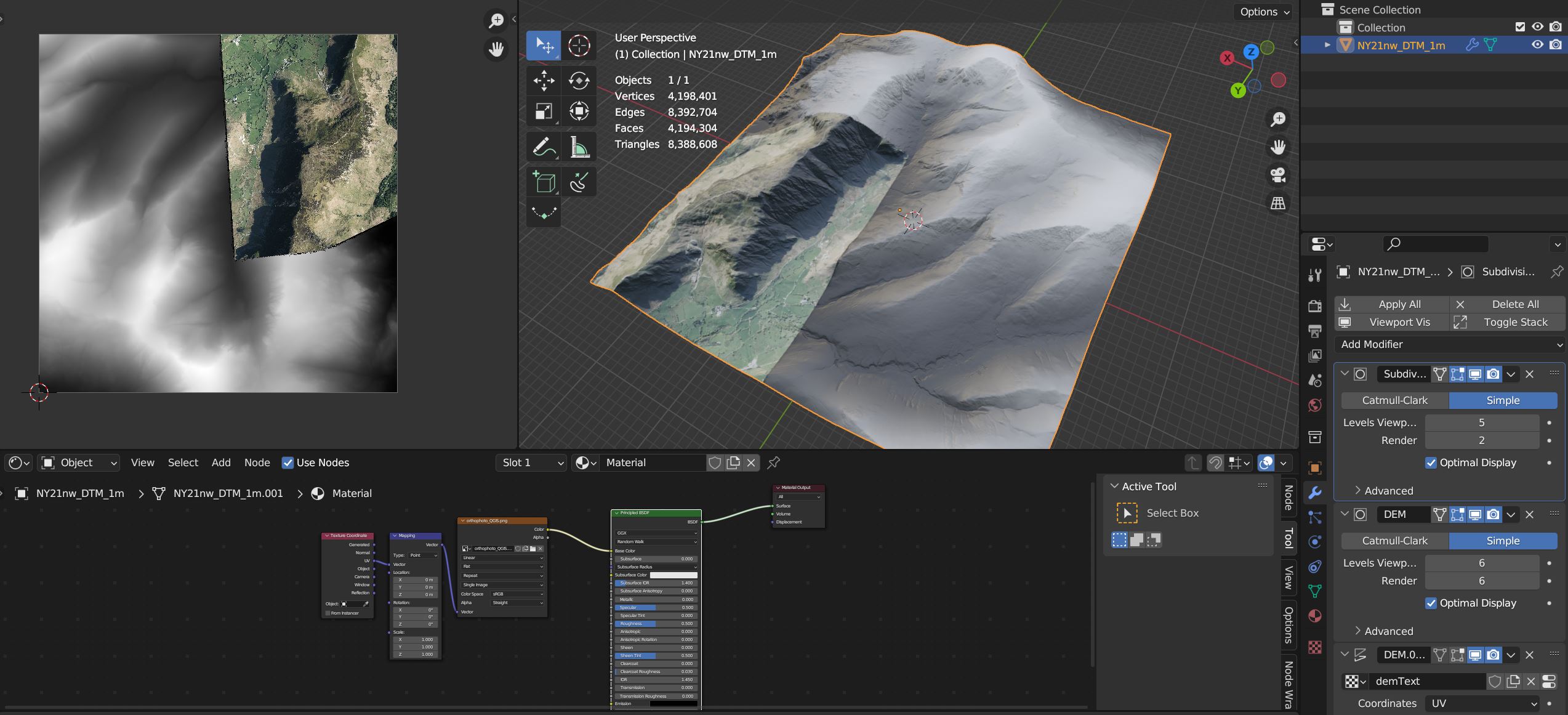
thanks, I think that has worked. How do I stick a satellite image on top of it?
Georeferenced Orthophotos are available from the same source:
But you better use an speciallized app like QGIS to work with them as they come in the ecw image format, not all areas seem to be covered, and come highly tiled so they have to be properly stitched before exporting then as texture for Blender.
In the example, after some adjustments in QGIS this is what you can afford:
Also, aerial photos come with “baked” shadows, you will need something like Agisoft Delighter if you plan to change the illumination of the scene.
Hope it helps.