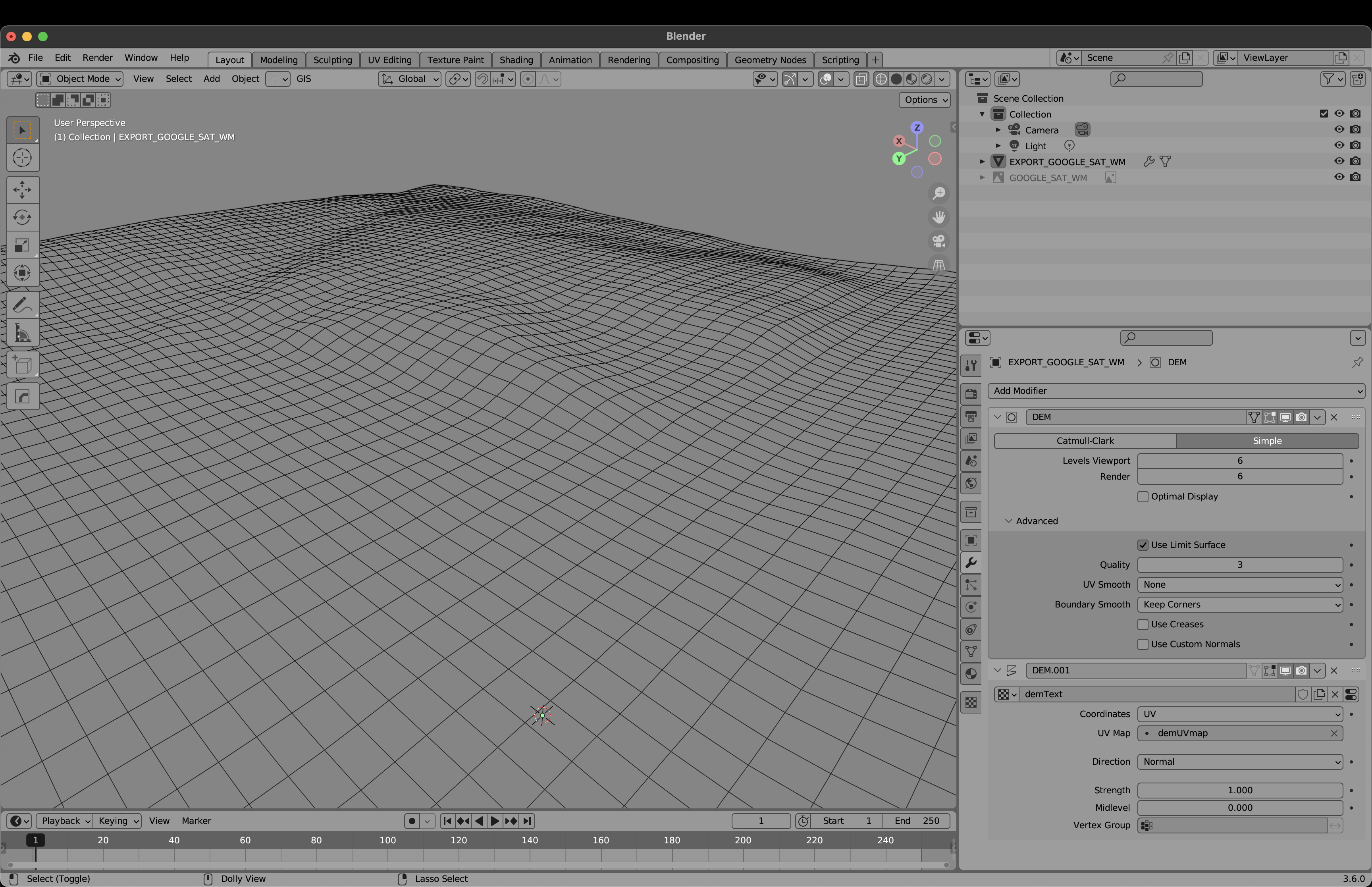
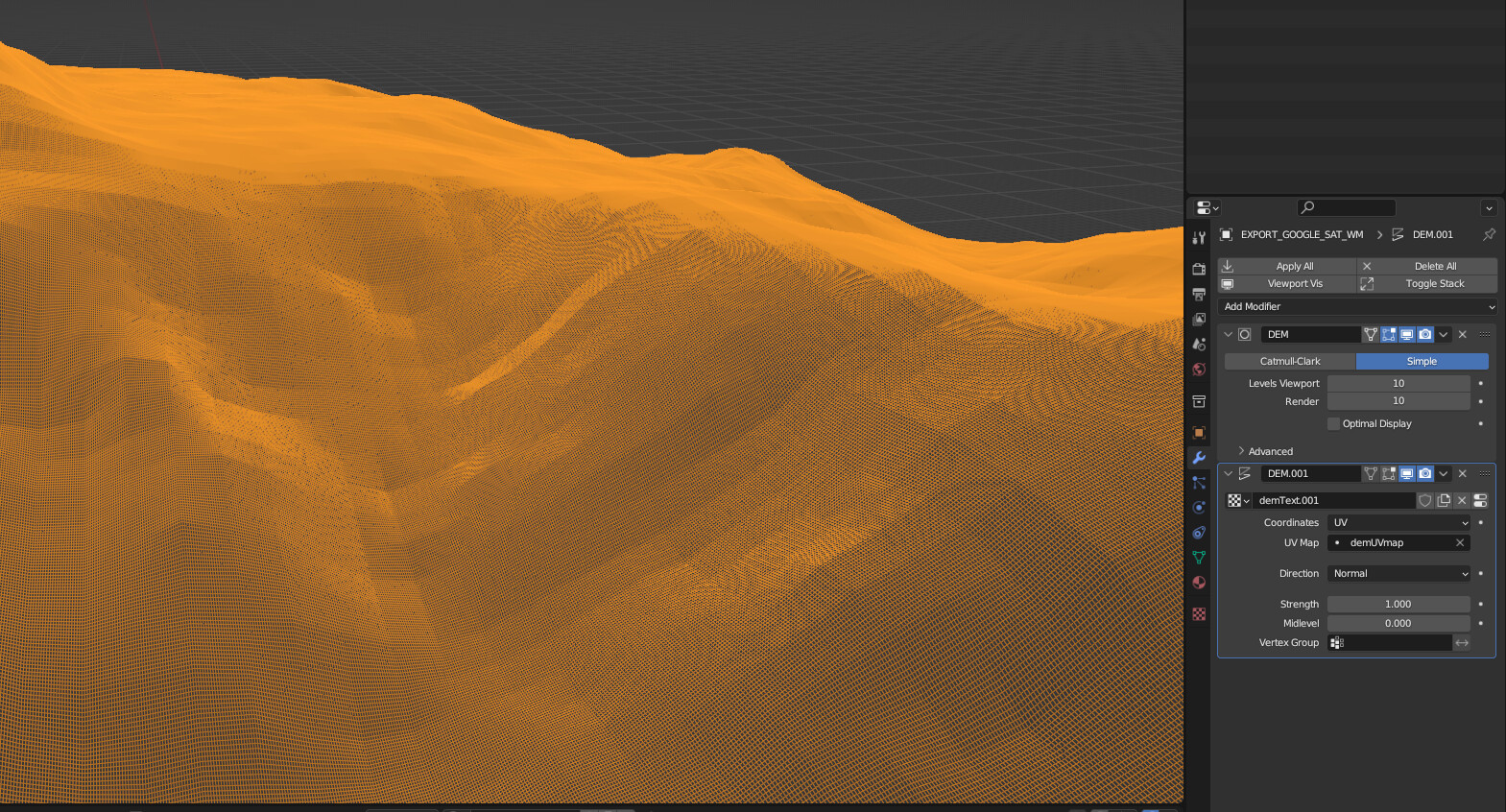
I haven’t experienced something like this before and it’s a bit confusing. I’m working with BlenderGIS to produce some topography using digital elevation model, but the subdivision on the addon seems to be capped at 6 no matter what I do.
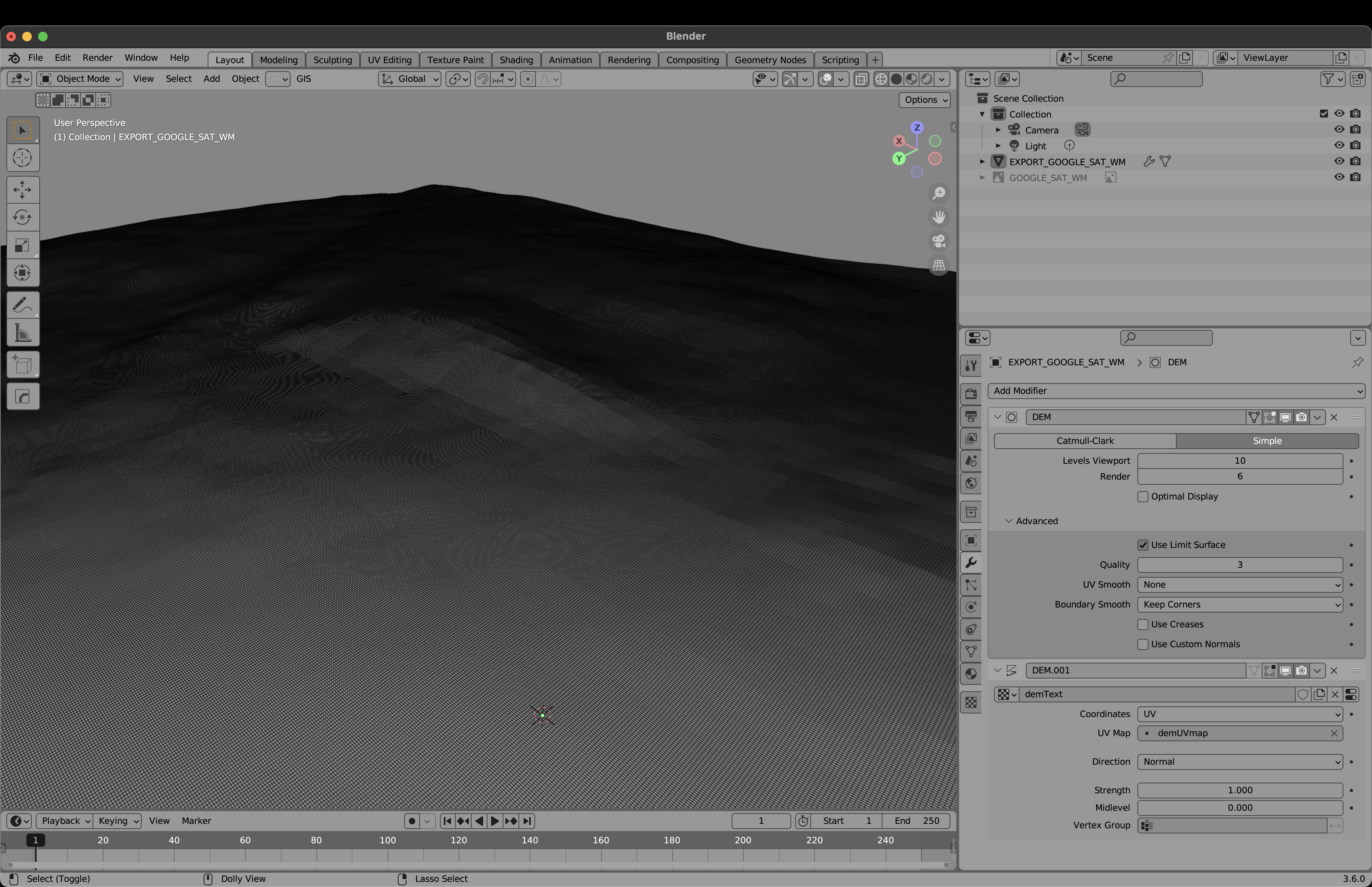
If I increase it to 10, there is a visual residue of some sort that references a lower subdivision level, rather than adding more detail. This trick seems to work for others when following their youtube tutorials.
Unless you’re using a displacement map or something to that effect, where more faces would equal more detail, I wouldn’t expect a subdiv modifier set to simple to add any detail at all. To the best of my knowledge, it’s literally just dividing the faces.
I don’t know which tutorials you’re watching, so it’s hard to say where the difference between their model and yours might lie.
Regarding the subdivision, it always has been “capped” at 6 and to increase it you have to type in the number, this is probably because you don’t want to accidentally slide it to 100.
and as G_De said simple subdivision just divides the faces while Catmull-Clark makes the mesh smoother.
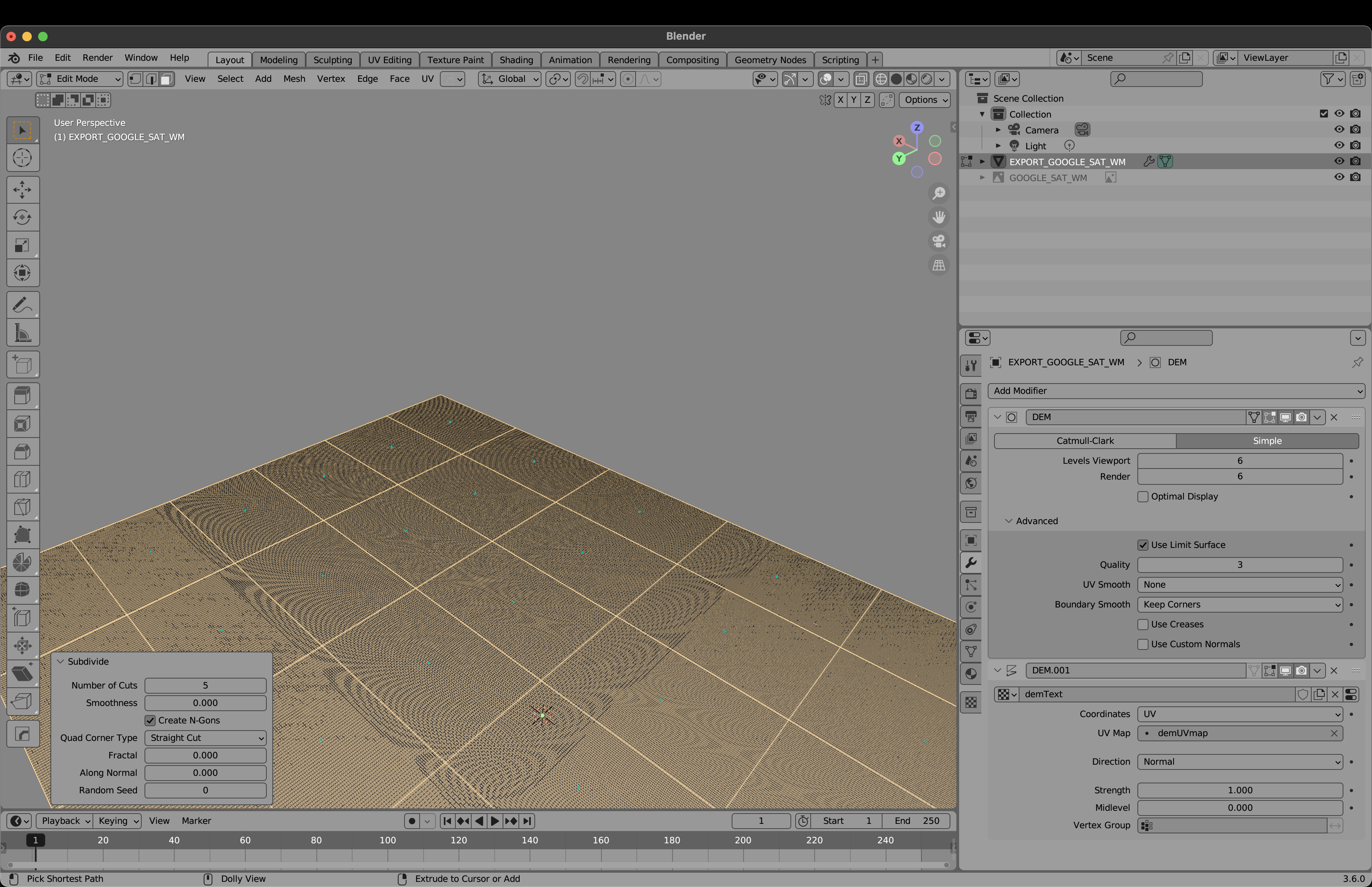
It could also be that the image used to displace is low resolution.
There is a displacement modifier actually. And the tutorial can be found here: https://www.youtube.com/watch?v=PmHxBn7F9Fw&t=306s. You can see that in this video, the subdivision can increase at 7:57.
This difference and the cap I understand well. I’m not a beginner at Blender. What I’m simply trying to understand is BlenderGIS’s implementation of the displacement and subdivision modifiers. Maybe I should post this somewhere else?
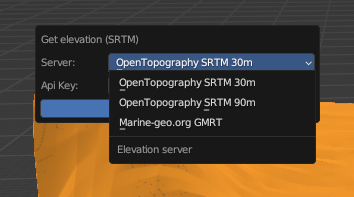
As I understand, world height maps are limited in resolution. So the resolution of your displacement map depends on how big of an area you’re capturing. It’s less about the addons implementation and more about the limitations of the data we have.
The area that the tutorial uses is probably a lot larger so it has a lot more detail, while yours a lot smaller.
Edit: Blender GIS has options for the height resolution, but as you can see its limited to 30x30m chunks for the highest resolution, so if for example the area you’re capturing is 60x60m then there is only 4 chunks in it