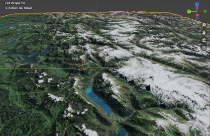
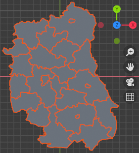
Import of very large terrain areas is possible now in blender-osm! The whole terrain of Switzerland is imported in the screenshot below. Get the new version using your purchase/download confirmation e-mail!
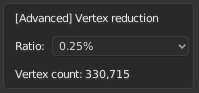
Use the reduction ratio in the terrain panel for the large areas to reduce the vertex number for the imported terrain:
That was made possible thanks to the contribution from our customer Allain. He publishes wonderful educational videos made with Blender in his Youtube channel. He used blender-osm addon to create his latest video about the physics of tides: https://youtu.be/hBsG8XtWeSA?t=996
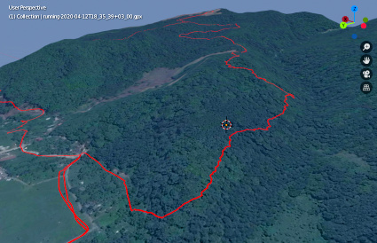
See your GPX hiking tracks in Blender with the blender-osm addon!
Import of GPX files is available in the latest version of the addon. Get it using the link your purchase/download confirmation e-mail or download the addon for free at Gumroad. Import the terrain and satellite imagery first. Then import GPX track.
Hello ! I’ve just purchased the premium version. It looks awesome,you’ve done a very hard work. After all these months, is it finally possible to export buildings with textures or is it still under development ?
@SquareRoot ,
Sorry for the delay with the reply.
A short Python script can be created for your case.
Script input: latitude and logitude of the center of the rectangle, dimensions of the rectangle
Script output: a string with coordinates of the rectangle that can be copied and pasted to the blender-osm addon.
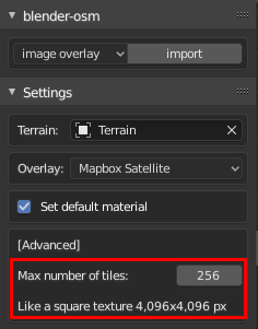
A highly requested option is available in the latest version of the Blender-OSM addon!
It’s now possible to set the maximum size of the resulting image for the satellite imagery to increase its resolution. The option is located in the Overlay section.
Hello, just set up the OSM blender plugin which is absolutely incredible. I was interested in building an area map to 3D print in tiles at home. I really like everything I’ve captured so far but am having a very difficult time learning how I can increase the height of the roads. Selecting the “layers” and hitting extrude does nothing for me. If I export the current file I have as an STL I pretty much miss everything other than the buildings. Would prefer to at least get some of the roads and details if possible. Thank you so much in advance, would love any info on the topic!
Thank you for the response! I may be a bit out of my realm here, is there a tutorial or blender manual page you can link me to for more info? Or just slightly more clarification? Sorry to be a bother. And thank you again for the help!
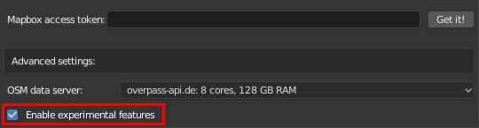
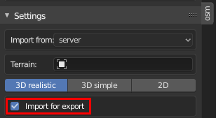
Export of textures to the popular 3D formats (FBX, Collada, OBJ, gltf) is now available in the Blender-OSM premium as an experimental feature. Update both the addon and assets folder. Check the options Enable experimental features at the very bottom of the addon preferences and Import for export in the addon panel.
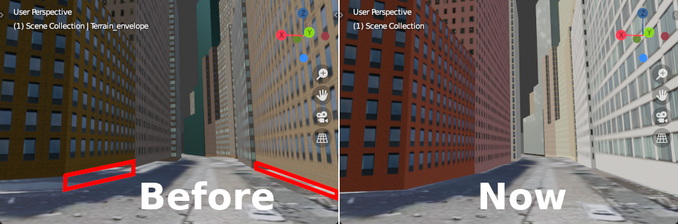
No more flying buildings over the terrain in the Blender-OSM addon (premium). Available with option Enable experimental features checked in the addon preferences. Update both the addon and assets.zip. Later the feature will be provided in the base version as well.
Is it possible to use the premium version to texture other buildings. If I create a simple building, can Blender-OSM premium be used to texture it, or do only osm imported buildings get textures?
Hi @GrrWood
The textures are applied to the buildings generated out of building footprints from OpenStreetMap. Custom building footprints are also possible.